Arrival
Friday 22nd June 1012 we nine intrepid walkers (Brendan, Richelle, Mary, Ita, Paddy, Gilbert, Shay, Pearse, Niall) left Dublin for the Appalachian Trail – or rather for a tiny part of it. The Appalachian Trail stretches for over 2,000 miles near the east coast of the US from Georgia to Maine. The threatening goings-on reflected in the film "Deliverance", which jumped to most people's minds on the mention of the Appalachians, were set in Georgia, far to the south of where we were going. We were headed to the White Mountains, New Hampshire, a State with the motto "Live Free or Die", of rugged individualism, with no general sales or income tax (but taxes aimed at visitors such as a meals and rental tax). The full hike is undertaken by about 2,000 people each year - about 200 completing it and taking about 6 months.
Being a regular visitor to the US I made straight for the US immigration area at Dublin Airport, queued there until I reached the officials only to be told that the Boston plane was not going from there but from a different gate with immigration control in the US, not Dublin. Time now short, I hurried there only to find my way blocked by a glass door. It was exactly the boarding time on my boarding card so I had the bad feeling that they had closed the door to late comers. There was no sign of the others so, presuming they were already through, I tried ringing them on my mobile. In fact I was the first there, and too early, the boarding time on the boarding card being incorrect. No problem, no rush. At Boston there was no delay at immigration, it was probably faster than it is in Dublin.
We were met at the airport by a small bus which brought us the three hour journey, over bone shaking concrete road, to our destination – the Appalachian Mountain Club (AMC) centre at Crawford Notch. Crawford Notch is in the middle of nowhere, there is no commercial centre and no shops, the nearest shopping area being North Conway 26 miles away. It is however down the road from Bretton Woods, an equally lonesome spot, but the location for the Mount Washington Hotel where the Bretton Woods Agreement was negotiated in 1944 which laid the groundwork for the IMF and the World Bank (incorporating the International Bank for Reconstruction and Development (IBRD) and the International Development Association (IDA)). A notch is what they call a pass in the White Mountains, apparently because there was no passage through the mountains before the Europeans arrived. The main Indian tribe had been the Abenaki who were decimated by diseases and pushed out of the area by the colonialists. Paddy came up with an easy mnemonic for Crawford Notch involving just the first and last few letters.
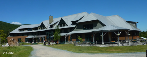 The AMC, at whose very comfortable Highland Centre we stayed, is one of the US's oldest outdoor associations. Founded in 1876 it supports outdoor activities and promotes preservation of forest including 37,000 acres it bought in 2003. It maintains the New Hampshire part of the Appalachian Trail and provides huts for hikers using the trail. Unlike parts of the trail in other states, however, the AMC charges for the use of these huts. Hence the sobriquets of "Appalachian Money Club", and "Dollar Mountain Club" used by some disgruntled hikers, and apparently the addition of a "$" sign on some of the AMC notice boards at trail heads.
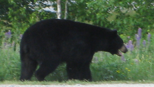 As we arrived at Crawford Notch we encountered a black bear, the only bear we saw in the whole trip. It was mooching around a building close to the AMC centre, snuffling at the building and peering into parked cars. Later in the evening Richelle bravely ventured out and took a photo of it, now beside the centre itself. The coincidence was so remarkable that we wondered was it a set up – the bear kept in a shed until some naïve travellers like ourselves arrived.
Mount Jackson (4052ft)
Not letting the grass grow under our feet, but also not testing ourselves too much, the first day's target was Mount Jackson. Mount Jackson is a peak in the Presidential Range, the part of the White Mountains which was our primary interest. The range is so called because the peaks are named after Presidents – starting from the south there are Mounts Jackson, Pierce, Eisenhower, Munroe, Washington, Franklin, Adams and Madison. The trail connecting the peaks is part of the Appalachian Trail. 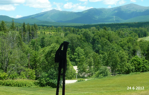 I wonder would it be a good marketing ploy to name the twelve Bens after our presidents or national heroes, or the Kerry mountains after Irish literary figures?
The AMC Centre stands at about 1900ft so this trek of about 8 miles incorporated a climb of about 2,200 feet. It was all on track and much of it was between contours. It turned out to be a good introduction to what was ahead of us as it was much more difficult than expected. 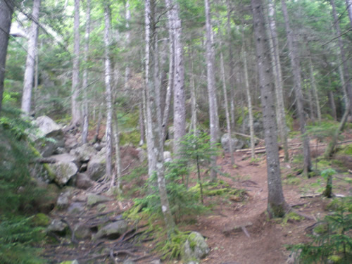 Though it was all on a track (as all walking in this area of the WhiteMountains is), the track was frequently no more than a series of boulders. In the photo, we took the path to the right; the trail was over the boulders on the left. Contours are 100ft apart on our maps so there was plenty of room for significant rises and falls while remaining between contours. We realised that walking speeds in the White Mountains would probable average about 1.5 mph!
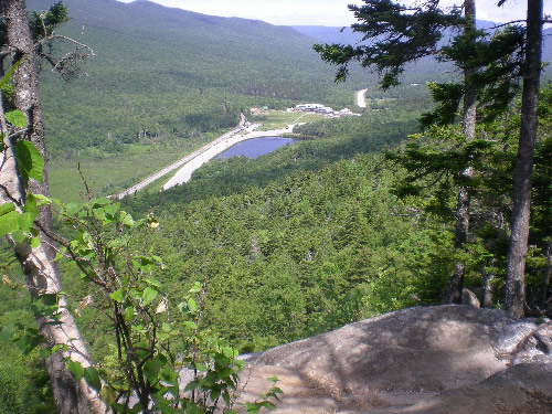 All of this walk was through forest (some of the other walks reached above the tree line), but it was still interesting particularly when crossed by streams. At one stage we found ourselves below a cliff, Bugle Cliff, which we knew we should be above. A young couple had just passed us and they too had gone wrong. Fortunately it was not too difficult to correct the situation and regain the track to Bugle Cliff from which there was a terrific view back to the AMC centre. On the way back we found the place where we went wrong – the "track", a heap of rocks, was virtually impossible to identify from the easterly direction.
As we approached Mt.Jackson we could hear a thunderstorm threatening. The last element of the climb is over a number of enormous boulders which were becoming quite slippery as rain was beginning to fall. At the top, which was very exposed and windy, we could see the storm coming nearer and it looked as if there would be only minutes before being engulfed by heavy rain and possibly lightning.
Obviously we did not want to be standing on an exposed peak when this arrived (the advice is: if in a lightning storm throw your pole some distance away as it may act as a lightning conductor). This, however, was our first peak in the trip, and a 4,000 footer at that, so Paddy naturally produced his camera to ask Gilbert the customary question "So, where are we now?" Gilbert's answer does not bear repeating, though preserved on the tape!
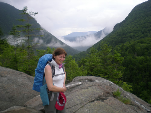 On the way back Mary and I took a short diversion to Elephant head, which is not as high as Bugle Cliff but also has a great view of Crawford's Notch. There is a rather touching plaque there commemorating a death – it does not record the name of the victim or the griever, if it is for a child, sibling or partner, if it was accident or suicide. The inscription reads:
If tears could build a stairway
And memories a lane
I'd make my way to heaven
And bring you back again.
Though only Mary and I enjoyed Elephant Head on this day, Paddy and Pearse came up on the Friday.
That night I left my walking pole outside at the Centre when quaffing a much needed drink of beer at the end of the walk. I did not notice this until the following morning and it never reappeared. This was rather surprising as the level of honesty throughout seemed to be excellent. However the centre had a facility for loaning trekking gear including poles so I was able to borrow one for the rest of the week.
The total Mount Jackson walk was somewhat over 8 miles.
Mt Eisenhower (4780ft), Mt Pierce (4310ft)
Sunday was a beautiful day. I decided to wear shorts, a decision to be later regretted. I put on plenty of sun tan lotion and insect repellent. We were driven to the trail head for Edmands Path which leads up to Mt Eisenhower. Mt.Eisenhower at 4780ft is somewhat higher than Mt. Franklin and our starting point was about the same height as before. However, though initially steep, this was a more pleasant trek than the day before, helped enormously by the better weather. There were some terrific views back to the valley overlooking the Mt.Washington Hotel.
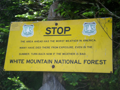 On the way we passed a sign warning us of the terrible weather to be expected. Mt.Washington experienced, in 1934, the highest wind speed ever recorded of 231 mph. It also recorded the worst wind chill factor of 100 mph winds at -47 degrees Fahrenheit. The weather is notoriously erratic largely due to the convergence of several storm tracks, mainly from the South Atlantic, Gulf region and Pacific Northwest.
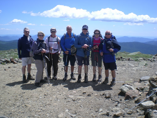 Mt. Eisenhower is above the tree line and its slopes are bedecked with a proliferation of delicate alpine flowers. They are so orderly that they look cultivated rather than wild. There are hundreds of trekkers crossing the mountain every day yet there was no litter to be seen. One of our group (not to be named!) strayed off the track and was quickly informed by an oncoming walker that this was not permitted. The views from Mt.Eisenhower itself were magnificent. Unfortunately in taking a group photo I took the inexcusable risk of stepping back, without looking, to fit the whole group into my picture. Standing on loose stones I, needless to say, stumbled sending camera, glasses and walking pole flying. Luckily no harm was done.
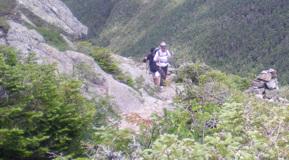
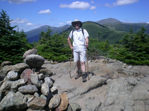 From Mt. Eisenhower we followed the Crawford path which leads back to the AMC Centre, taking a diversion to include Mt. Pierce, 4310 ft, (obviously with a photo of Pearse on Pierce) and a look in to the Mizpah Spring Hut. Visiting the Hut on this beautiful day gave us some (false) idea of what would await us when we overnighted later in the Lakes of the Clouds Hut before completing the climb of Mt. Washington.
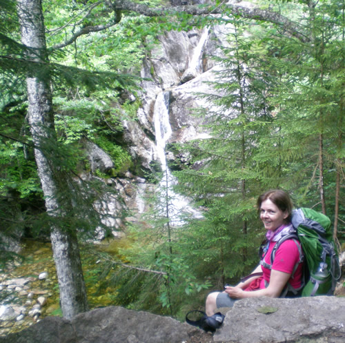
Towards the end of the walk, as we approached the main road we passed a rather impressive waterfall, the Gibbs Falls.
Here too is the start of the Crawford path, a trail to the summit of Mt. Washington since 1819.
A Note on the Trails
I have indicated that the trails can be quite difficulty to identify. There are, however, a couple of aids to this. Colour coding is used to distinguish various trails (The Appalachian Trail is yellow). So the appropriate colour (or colours if more than one trail is using a particular path) may be painted as a band on trees or rocks where the trail route is doubtful. In open areas cairns are used to identify routes as well as for marking the top of a peak. It was often a relief, in poor visibility, to see a cairn emerging from the mist confirming that we were on the right track. We were not aware of this system when ascending MountJackson (we had only seen the sign posts which are placed where tracks meet) and I cannot say if there was a tell-tale mark which would have prevented our error on that occasion.
Day Off
The original plan was to hike to the Lakes of the Clouds Hut on Monday before ascending Mt. Washington and following this with a rest day. The weather forecast however threatened severe lightning storms and poor weather for the next few days before clearing at the end of the week. Consequently we decided to take Monday as the rest day and go to North Conway to browse the shopping outlets there. This was just as well since we suffered the mother of all storms which would make you never again complain about Irish rain, and lightning flashing right over us. It was also useful in that we all purchased sleeping bag liners for use in the hut when we eventually got there.
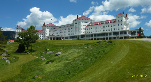 On the return journey we stopped at the Mount Washington Hotel for a bite to eat. It is an immense hotel, more or less the last remaining from 200 hotels which were popular at the end of the 19th century before the proliferation of the motor car substituted short trips for long holidays and before sun holidays became the norm. The hotel is very impressive having recently had $50-60 million dollars spent on it.
The "gold room" where the Bretton Woods conference was held is preserved and roped-off. We had a pleasant and inexpensive lunch. Despite the grandeur the beers came in true American style – no glasses! The waitress judged Paddy's pizza to be under par so she got him another one, and gave him a free beer while he waited. Then in the final bill she did not charge him for the meal either! Earlier in Starbucks I offered a $50 note to pay for a cup of coffee so they said they would not charge me at all!
Because we had changed our day away for staying in the hut rather than the centre, we had to change rooms that evening. The resulting chaos was a situation comedy of people entering rooms already occupied and disturbing couples in compromising positions. The AMC is largely resourced through volunteers and this certainly told in their expertise in allocating rooms.
Mt Avalon (3442ft) and Mt Tom (4051ft)
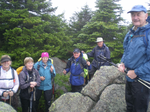
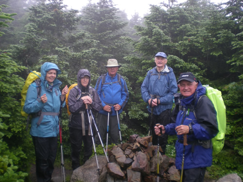 By Tuesday bites I received (from the notorious black fly?) populated my leg so I reverted to long trousers. In any case the weather, though warm, was still poor. We had intended to go to Zealand Falls but as lightning again threatened we hiked instead to Mt.Avalon (3,442 ft) which provided a shorter route back if required. These are to the east of the AMC centre, the opposite direction from the presidential range. The weather held apart from some heavy showers however so we also took in Mt.Tom (4,051 ft). The climbs were as usual steep and rugged and mostly heavily wooded with occasional views and plenty of streams. There was a servere dip between Avalon and Tom so the climb was greater than it looked. Distance about 7 miles. Considering the conditions it was a very worthwhile day.
Evenings at the AMC Centre
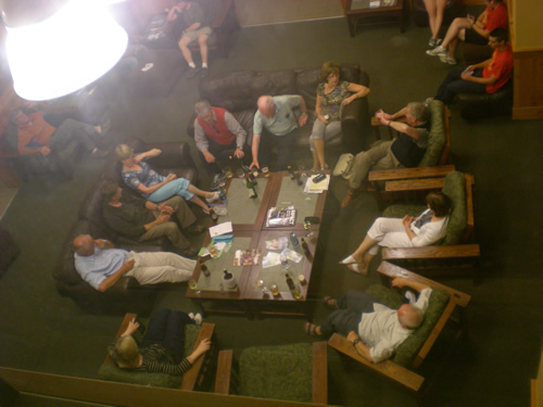 Dinner at the centre is invariably at 6.00 pm which ensured our return before this, hopefully with time for a beer before changing. The food was surprisingly good, as was the wine, particularly a Pinot Noire. There are a number of sitting areas around the building though bringing drinks was only allowed in one – where we tended to congregate (& dominate). The ethos of the AMC is one of socialising with other visitors hence long tables to eat at. Ours being a group of nine however was limited in this regard, though we did meet a few who ventured to join our table. One, Michael from Dublin and living in Boston for twenty years, particularly and mysteriously enjoyed our company after the meal even though we were talking shop (i.e. about the operation of the Trekkers).
Ammonoosuc Ravine Trail to Lakes of the Clouds Hut (5000ft)
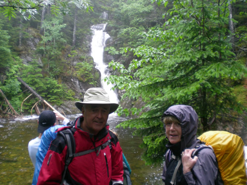
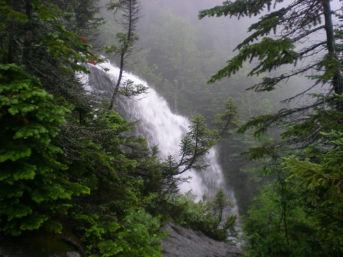
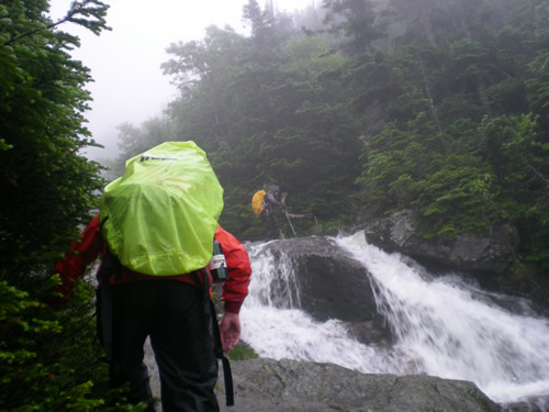
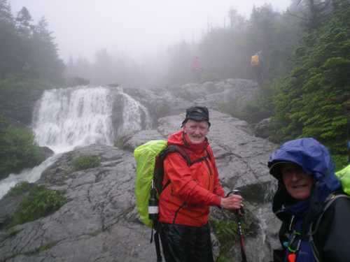
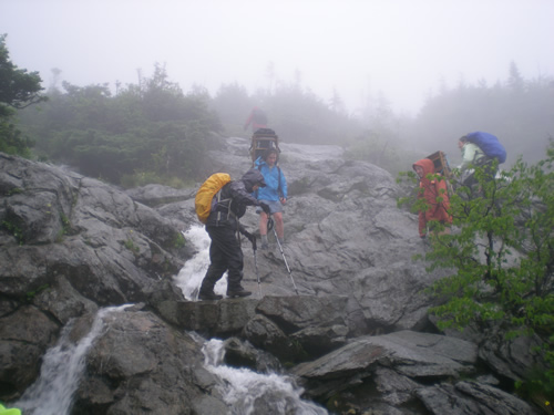 Wednesday then was the day set for the trek to the hut.I think we all looked forward to this and the following climb to Mt.Washington as the highlight of the trip and it certainly fulfilled its promise.The weather was poor but walkable. The Ammonoosuc Ravine Trail is 3.1 miles of largely difficult and very steep terrain which took the day to traverse.("Weren't you great to go trekking" say our friends, "How far did you walk in a day?"…. "3 miles" …"Oh …"). There were a large number of hikers coming down the trail as we went up, including some youngsters.They warned us of heavy flows on the rivers we had to cross. Due to weather conditions at the top walkers who had intended to continue on the Appalachian Trail had been redirected down the mountain. As it turned out the conditions, though bad, were not as bad as the worst prophets of doom we met had described. Still it was a long, slow, difficult climb and we were very glad to reach the hut. Any idea of continuing up Mt. Munroe which is only 0.3 miles further on and 300ft higher (at 5,372ft) was quashed by a combination of fatigue, poor visibility, high winds and the general embargo applying to hiking in that direction.
Lakes of the Clouds Hut
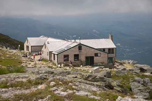 The Lakes of the Clouds Hut is situated at 5,000 ft., close to the peak of Mt. Monroe and 1.5 miles from the peak of Mt. Washington. There are two lakes (we skirted one but could not see its extent) and the views are apparently spectacular but we would not know anything about that. At the top of the Amonoosuc Ravine Trail, there were fortunately cairns to mark the way to the hut, otherwise we could not possibly see it, 50 metres away. It was difficult to stand or move against the driving wind and rain, but a great relief to see the hulking building emerge from the mist.
The hut itself is quite large, it can house 90 travellers, there were about 70 the night we were there. Sleeping quarters were narrow rooms with triple tiered bunks – 12 bunks to a room. There was no gender separation between rooms – this did not constitute a problem as, far from disrobing, the inclination was to add further layers against the winds and rain which penetrated the windows. Our rain gear was soaking from the climb so any possible space was used on which to hang it. When hung near a window they were even wetter in the morning due to the leaks. Only later did we realise that there was a space near the kitchen where the cognoscenti hung their wet gear. There were a couple of windmills on the roof, of which the AMC were very proud – unfortunately one of them was broken and howled unmercifully all night. They are also very proud of their waterless toilets and recycling of human waste - so as well as the howling windmill above there is the whistling wind below as you sit on the toilet, feeling very fragile. The electricity was turned off at 9.30 so if you needed to use the toilets before daylight you used the head light you hopefully remembered to bring. Luckily no-one snored in the room some of us were in – not so fortunate were the others where a youngster talked in his sleep all night.
Dinner and breakfast are provided at the hut – both were surprisingly good. No drink was served, but of course we brought our own answer to that from the duty free in Dublin. The AMC give a festive air to the meals, calling out those who prepared and served the food for congratulations. In the morning they put on a comic performance demonstrating the exercise of muscles to leave the place in good order, by – folding the blankets, keeping any trash, using the heart – i.e. exercising a spirit of comradeship and co-operation. In the morning they also gave awards to kids for completing a specified number of pages of the Junior Naturalist Activity Book. The activities in the book are simple and informative, focusing on wildlife, leaves, weather, astronomy, mapmaking and suchlike. We should have acquired a copy - it looked an excellent entertainment and educational vehicle.
Trekkers undertaking the Appalachian Trail do not have to pay the overnight charge ($114!) if they help out in the kitchen or otherwise. On this night two did this by giving an account of their experiences on the trail.
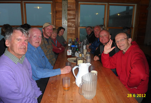 Lakes of the Clouds hut.
(the guy with the cap is John from the AMC, who organised the trip with Brendan and who acted as our AMC guide up Ammonoosuc and Mt Washington – the only trips on which we used a guide.)
Mount Washington (6288ft)
On Thursday we finally reached the peak of Mount Washington, 1.5 miles and about 1300ft climb. Again the weather was atrocious coming from the Lakes of the Clouds huts. On the way we were passed by two of the Hut volunteers with enormous packs on their backs, being the refuse from the hut on its way to Mount Washington.
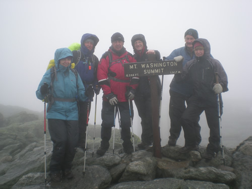 The peak of Mt Washington itself is not the most interesting from a trekking point of view though it is the highest in the North Eastern US. It is disfigured by multiple communications masts (though not any to give us a mobile signal). It can be accessed by a road from the west and by a cog railway from the east as well as by trekking trails. It has a large building incorporating eating area, souvenir shops and museum. This also contains a notice board listing the deaths on the mountain. The latest on the board was 1/4/2012 for a man who fell into a crevasse. He and his son hiked Tuckerman's Ravine (on the west side of the mountain) every year but this year he slipped, hit his head, and slid and fell more than 70 feet into a crevasse.
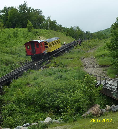
We had a snack, dried out and rested for a bit before heading off for the downward journey by the Jewell trail, somewhat over 4 miles. Some took the cog rail down and relieved some of the rest of the weight of their bags. A great idea until we came out of the cloud into sunshine below and we had no bag to hold our coats, and, of course sun tan lotion and insect repellent were also in the bags. Still it made a very light journey. On the way we took in the actual peak, a short distance from the restaurant followed by more very rough going. Then it improved for the rest of the descent. We crossed the rail for the cog railway on the way, just before the train emerged out of the mist. It passed with cheery waves from the kids aboard and was swallowed up as promptly as it had appeared. Between this and the tree line there was a prairie-like spread of Balsam Fir which, above a certain height, only grows to a few feet and provides a very pleasant ground cover.
We all met up at the base of the cog railway. There we saw a chipmunk. In general we had seen little animal life apart from this, the bear, and a squirrel chattering and running madly around some trees in an immense rectangle beside Elephant Head (& a sign for "Moose Crossing").
Mt. Willey (4285ft) & Mt Field (4340ft).
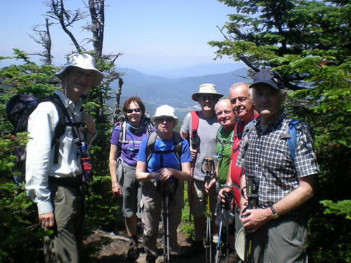 Friday was our last opportunity for walking so we decided to try a final decent walk taking in Mts Willey and Field, to the East of the Centre. We were joined by Dermot, a friend of Brendan. Dermot and his wife Pam had come from Canada to be with us and joined us after dinner on Thursday evening. They were to greatly enhance our singsong on Friday night. Paddy and Pearse, on a separate walk, took in Elephant Head and Willie's house.
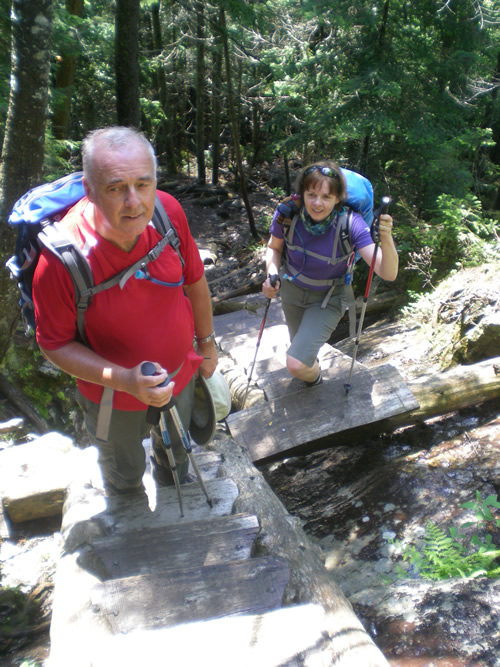
The climb to Mt Willey by the Kedron Flume track and taking in again a part of the Appalachian Trail, presented spectacular views. Some of it was so steep as to be provided with "ladders" attached to the vertical rocks. The saddle from Mt Willey to Mt Field was relatively easy and Mt Field provided a magnificent view west with Mt Washington Hotel in the distance. Returning from Mt Field we passed Mt Avalon where we were earlier in the week – we were so confident of our expertise on the trails at this stage that we went slightly off the track again! The distance was about 7 miles, over 2,500ft climb.
Last Hurrah!
The customary singsong was duly held on the Friday evening.The AMC Centre did not seem ideal for this so Gilbert exercised his magnificent organisational skills to have the Mt Washington Hotel (no less) send a minibus to bring us up there. Dermot had brought his guitar, a great repertoire of songs, and the voice to match. His wife Pam had gone on an AMC walk on Friday morning, the only other visitor on the walk being Paul from New Jersey (or as he told us to say "New Joysie"), so we invited him to join us for dinner and later to the singsong. He was 84 and had been climbing the Ammonoosuc trail regularly until he was 82. Though a jew he had been to many catholic confessions as a boy. Not quite, but he went with his catholic friend, waited for him in the church, and weekly quizzed him on his sins. He said he was impressed more by jewish confession, which requires compensation for the victim and not just a commitment not to re-offend. A liberal in politics he was surprised that the Irish would classify Irish politics as left of the Democrats in the US. The American Irish he meets as a lawyer, though their parents would have been Democrats, have now gravitated to the Republican Party.
A great time was had by all in the Mt Washington Hotel. Everyone contributed something. Dermot led with a great range of songs, Brendan sang solos, Brendan and Ita sang a duet, Gilbert sang a solo as did Richelle. Led by Pam she, Mary, Richelle and Ita danced a four handed reel. As the time went on people began to assemble around us; apparently we were more entertaining than the pre-wedding entertainment elsewhere in the hotel. Paddy, as well as contributing his usual marvellous songs hob nobbed with the new audience. The most popular piece for this throng was Pearse's rendering of "The Wild Rover" which we sang a number of times on request. My contribution to the evening was a trekking poem, "Over the Top" in the form of Chesterton's "Lepanto".
A memorable interlude occurred when a stocky man in his sixties lunged from the onlookers, jumped on a table, and proceeded to sing a very bawdy, crude song from his days in Vietnam. His daughter was there, who, instead of being mortified, was delighted, telling us that he had never done anything like this before - she was totally unaware of this side to him. Her mother is from Galway and she is coming to Ireland and, of course, fully intends to seek us out.
Paul felt he had not contributed to the evening (quite wrongly as he had driven Dermot back to the Centre to get his guitar). So, as we congregated later back at the AMC Centre he shared a joke with us:
A reporter goes to Israel. She is looking for something emotional and positive and of human interest. She hears about an old Jew who had been going to the Wailing Wall to pray, twice a day, every day, for a long, long time. So she went to check it out. She goes to the Wailing Wall and there he is! So she watches him pray and after about 45 minutes she approaches him for an interview. "Sir, how long have you been coming to the Wall and praying?" "For about 50 years." "What do you pray for?" "For peace between the Jews and the Arabs. For all the hatred to stop. For our children to grow up in safety and friendship." "How do you feel after doing this for 50 years?" "Like I'm talking to a f***ing wall."
There Goes My Next Paycheck
A final photograph on Saturday and we were off home. A last unexpected bonus came in the form of a telescope set up outside the Centre to view the sun - it revealed a flare rising from a position of about 1 o'clock on the sun's surface and clearly curling and trailing way. Often seen in pictures, it is much more impressive when seen in reality.
A more comfortable bus this time, but again we suffered the dreadful roads. They were so bad in fact that the bus hit the safety railing in the Boston Tunnel, destroying a mirror. The driver, she seemed desperately young, was naturally very upset. Given the nature of the road and way the railing was obtruding, we felt the fault was not hers – a small damper on the end of the great holiday, we hope it did not affect her prospects too much. Otherwise we arrived in Dublin without incident – a marvellous holiday.
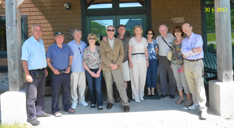 Trekkers' last day (with Dermot and Pam; taken by Paul)
